
GIS Platform Modernization and Accessibility Enhancement
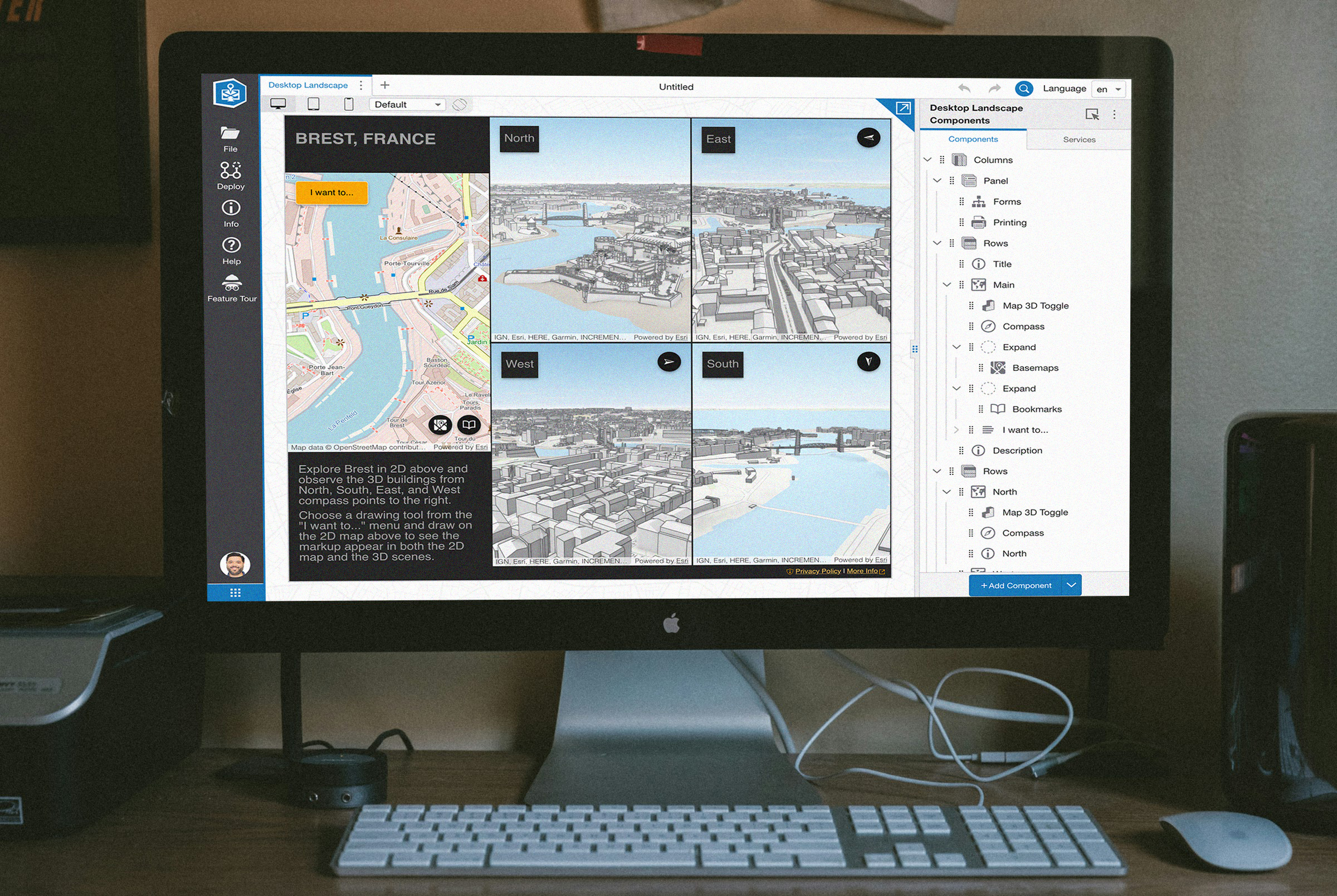
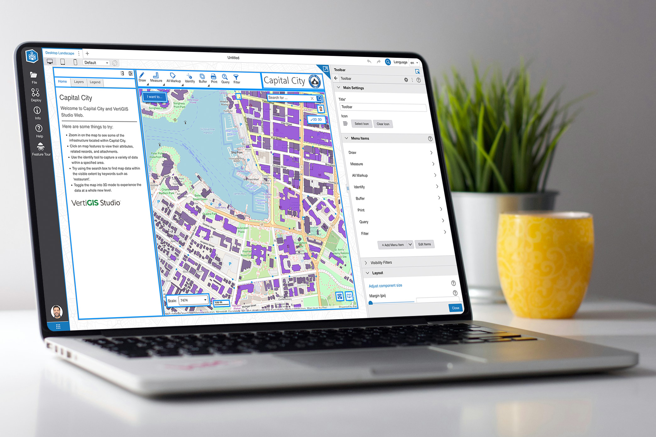
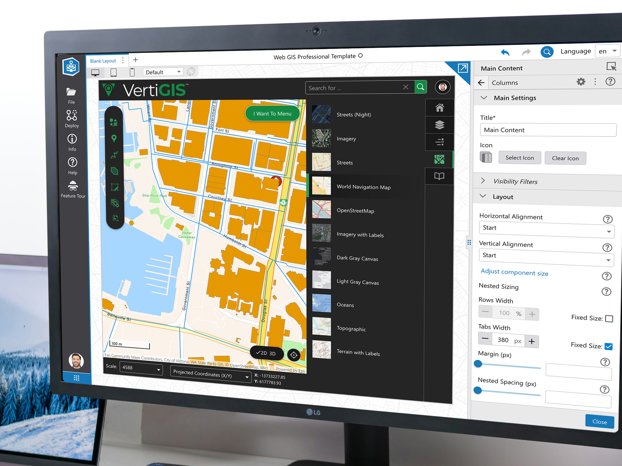
As part of a major modernization effort for a GIS platform, our team led the initiative to prioritize accessibility and user customization. Central to this endeavor was the implementation of customizable layouts, allowing users to tailor their workspace to their specific needs and preferences, increasing productivity and satisfaction.
Recognizing the diverse needs of our global user base, we invested in comprehensive internationalization support. This involved not only language translation but also cultural adaptation (RTL support), ensuring that users from different regions could seamlessly navigate and interact with the platform.
Accessibility was a core focus throughout the modernization process. We conducted thorough accessibility audits and implemented necessary improvements to ensure compliance with WCAG standards, creating an inclusive environment where all users could effectively engage with the platform.
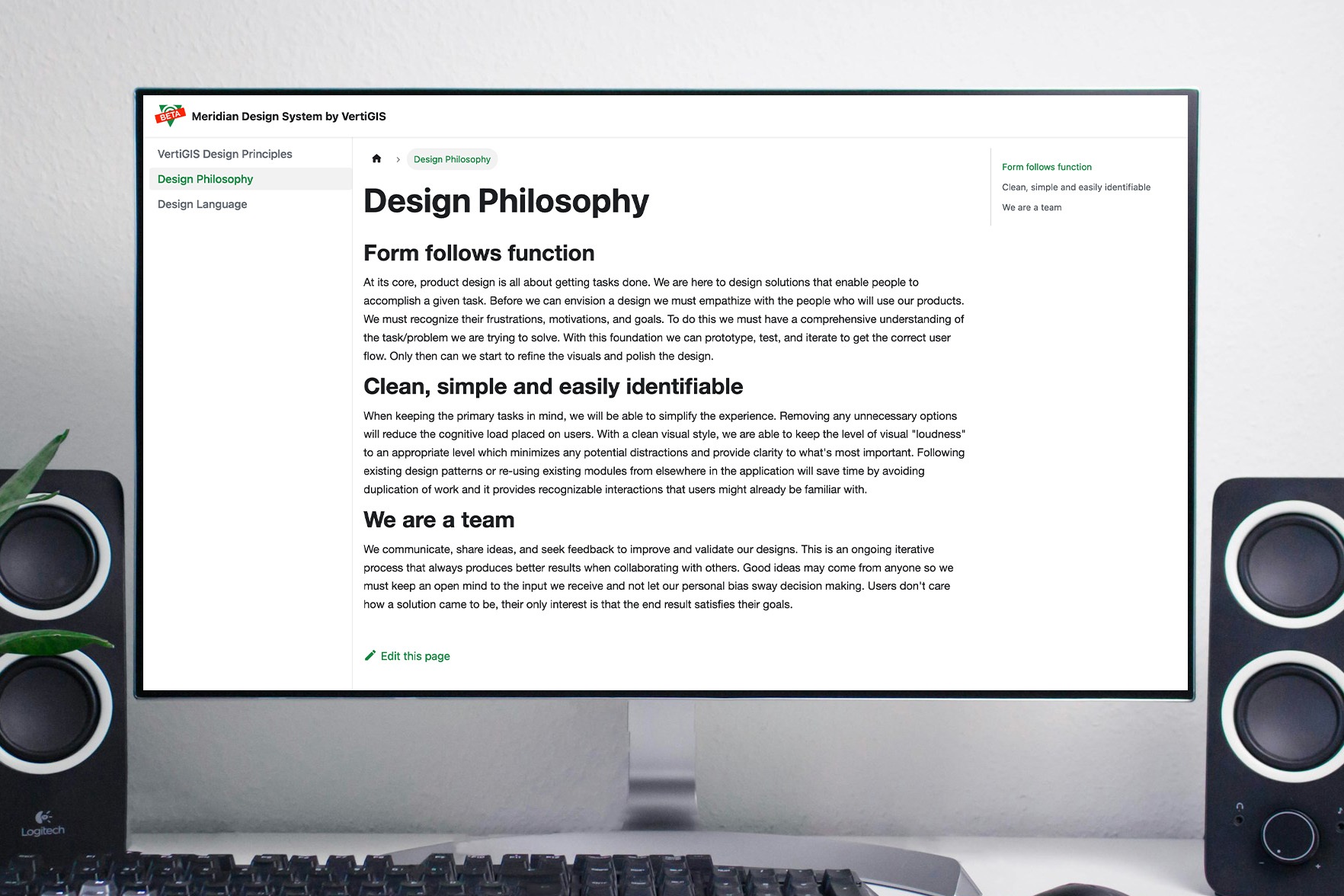
Creating a Unified Design Ecosystem
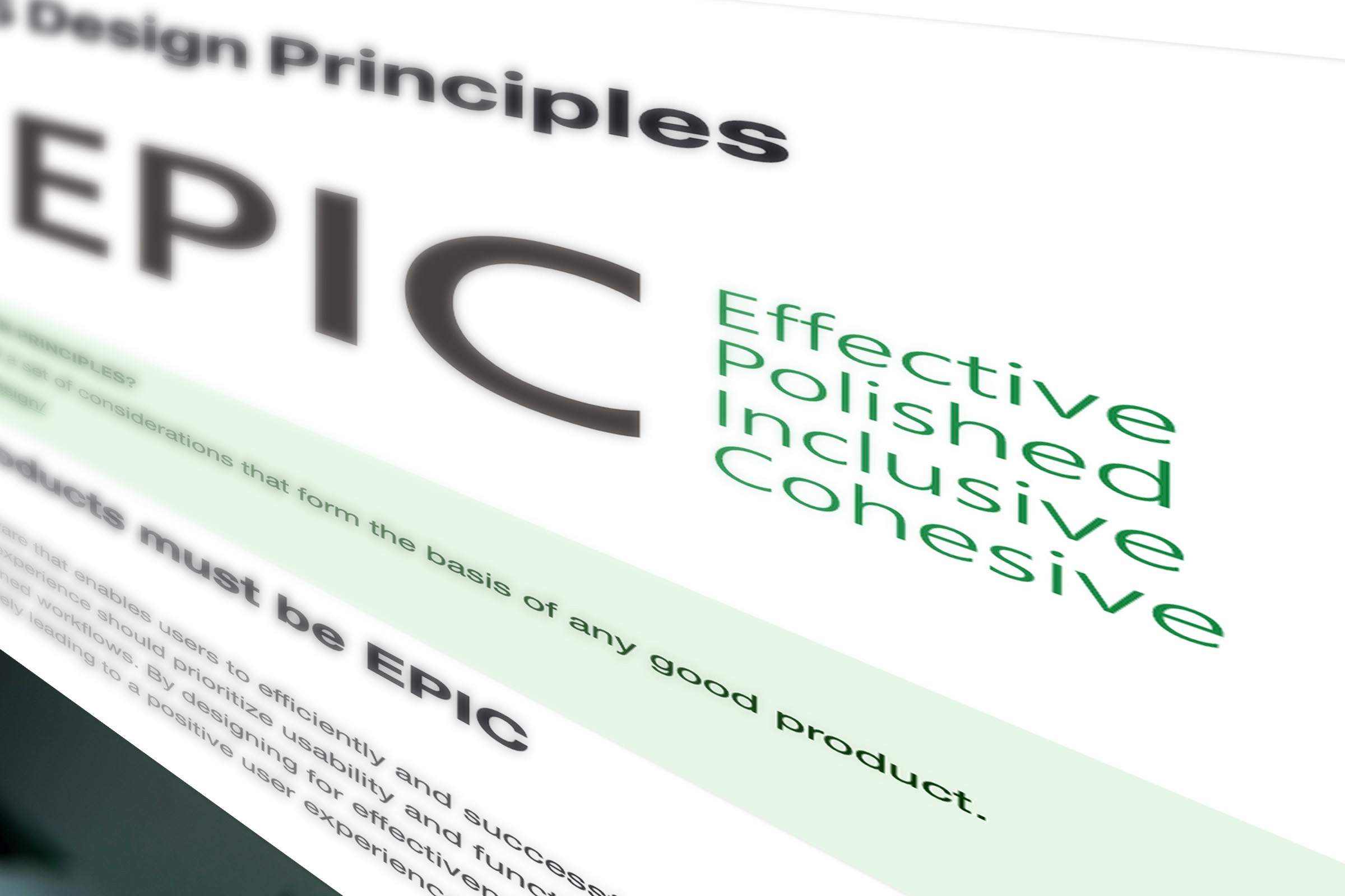
Leading the charge in establishing a unified design ecosystem for our global organization, we embarked on three transformative initiatives: developing a comprehensive design system, crafting guiding design principles, and defining a cohesive design philosophy.
Our design system serves as a centralized repository of design guidelines, fostering consistency, efficiency, and scalability across all products and platforms. This initiative promotes collaboration, creativity, and innovation while ensuring brand consistency and quality assurance.
Complementing the design system, our guiding design principles provide a shared framework for decision-making, emphasizing user-centricity, simplicity, consistency, and inclusivity. These principles empower teams to prioritize the needs and preferences of our diverse user base, resulting in more cohesive and impactful design outcomes.
Grounded in empathy, curiosity, and human-centered design principles, our design philosophy articulates our values, vision, and approach to design. It celebrates diversity, inclusivity, and accessibility, while fostering a culture of experimentation, iteration, and continuous learning.

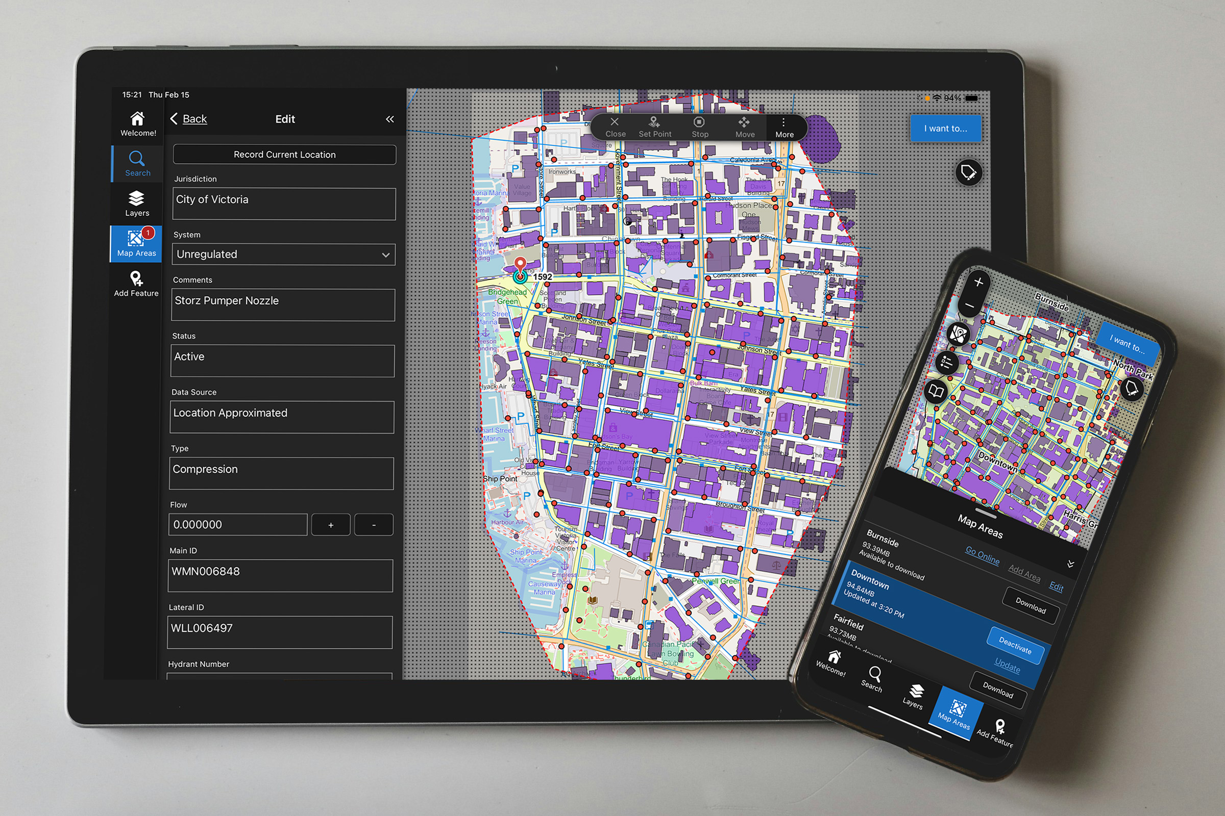
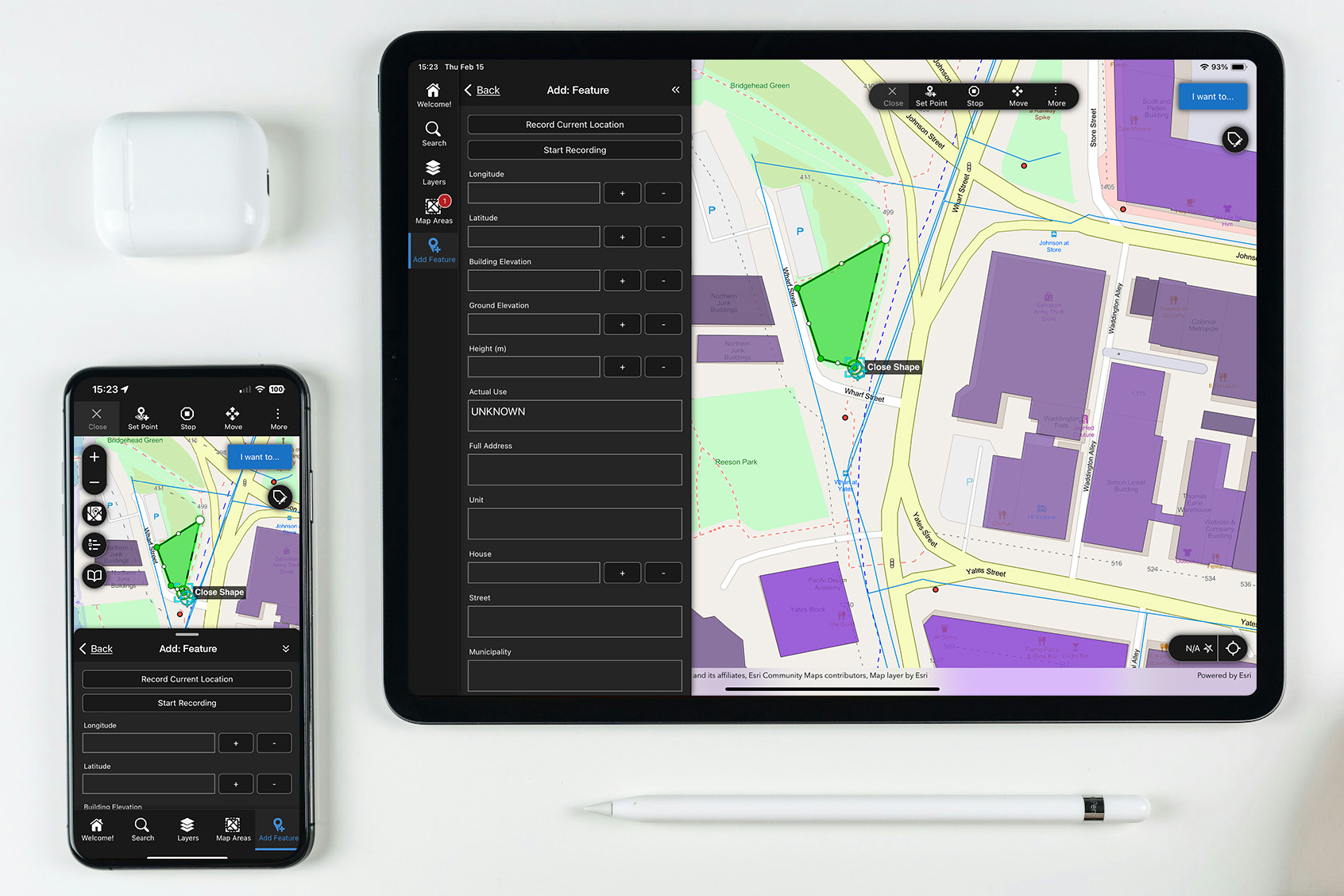
Mobile App for Offline Location-Based Asset Management
Our team developed a robust mobile application tailored for offline location-based asset management, catering to the unique needs of field workers operating in remote or low-connectivity environments. This cross-platform solution ensures seamless access to critical data and functionalities, enabling field teams to stay productive even without internet access.
One of the key highlights of the application is its powerful map markup capabilities, allowing users to annotate maps with precision and detail directly from their mobile devices. This intuitive feature facilitates efficient data collection and communication, empowering field workers to make informed decisions on the go.
Built-in location-based asset management functionalities equip field teams with tools for tracking, updating, and managing assets in real-time. From asset inspections to maintenance tasks, this comprehensive solution streamlines field operations and enhances overall productivity, ultimately driving operational excellence.
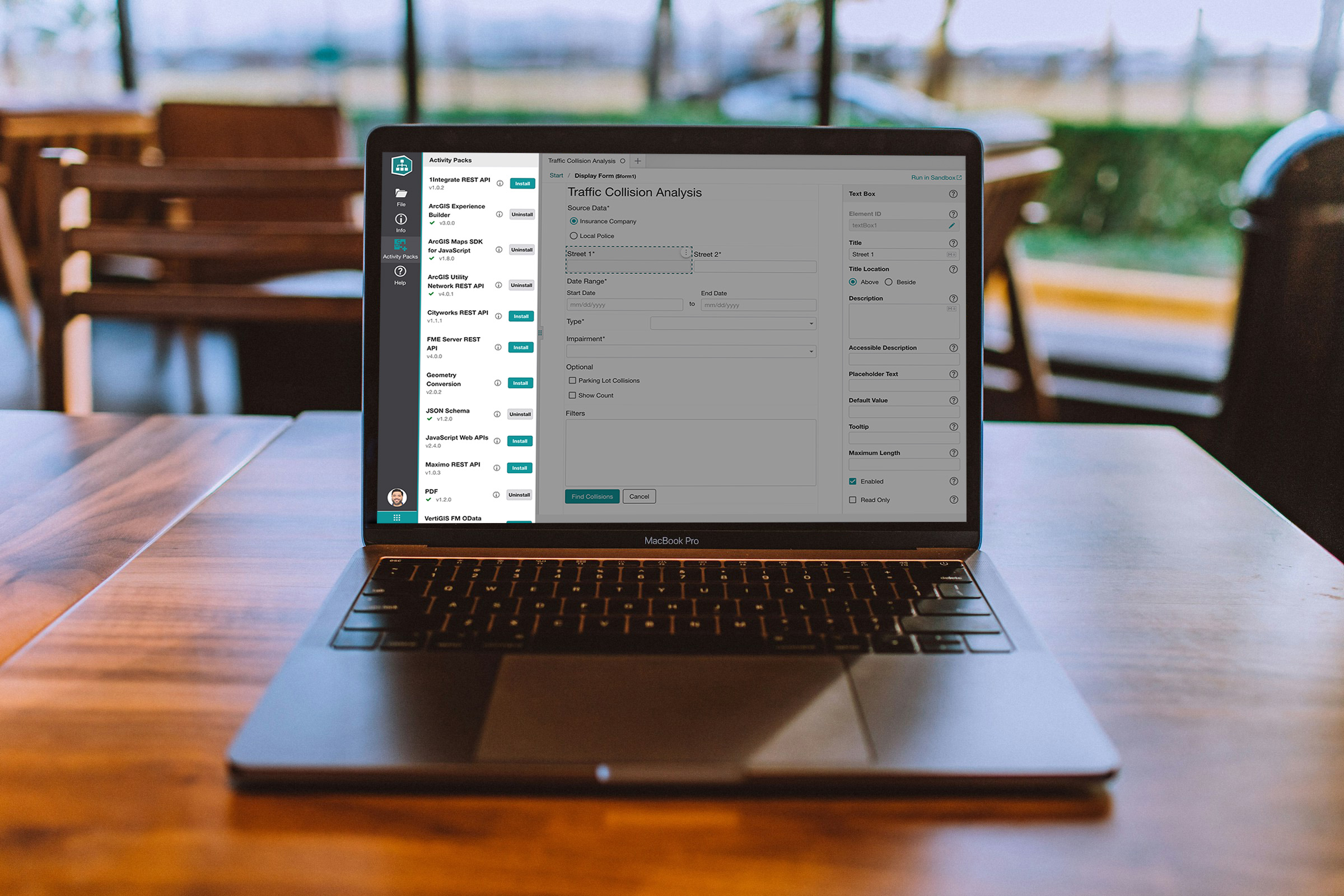
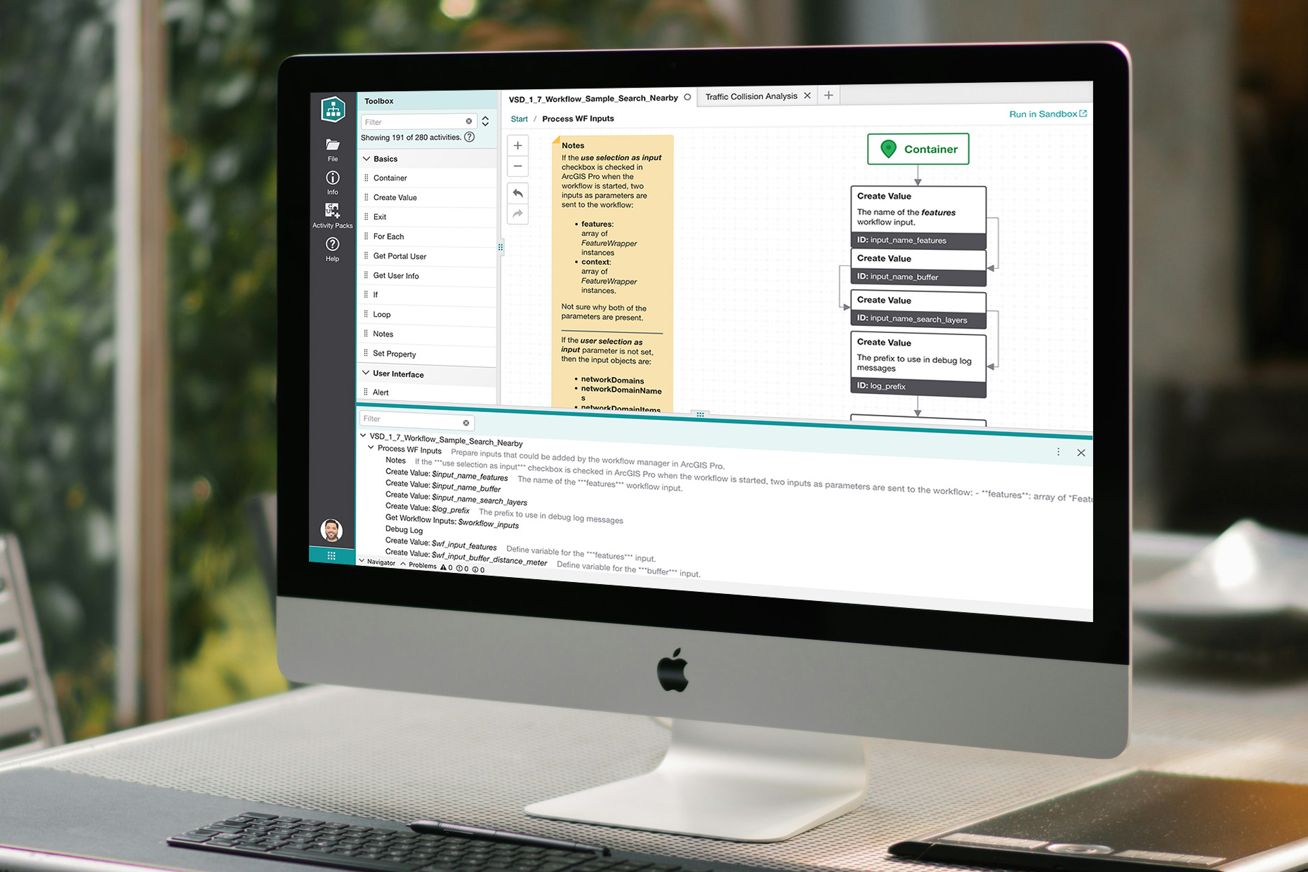
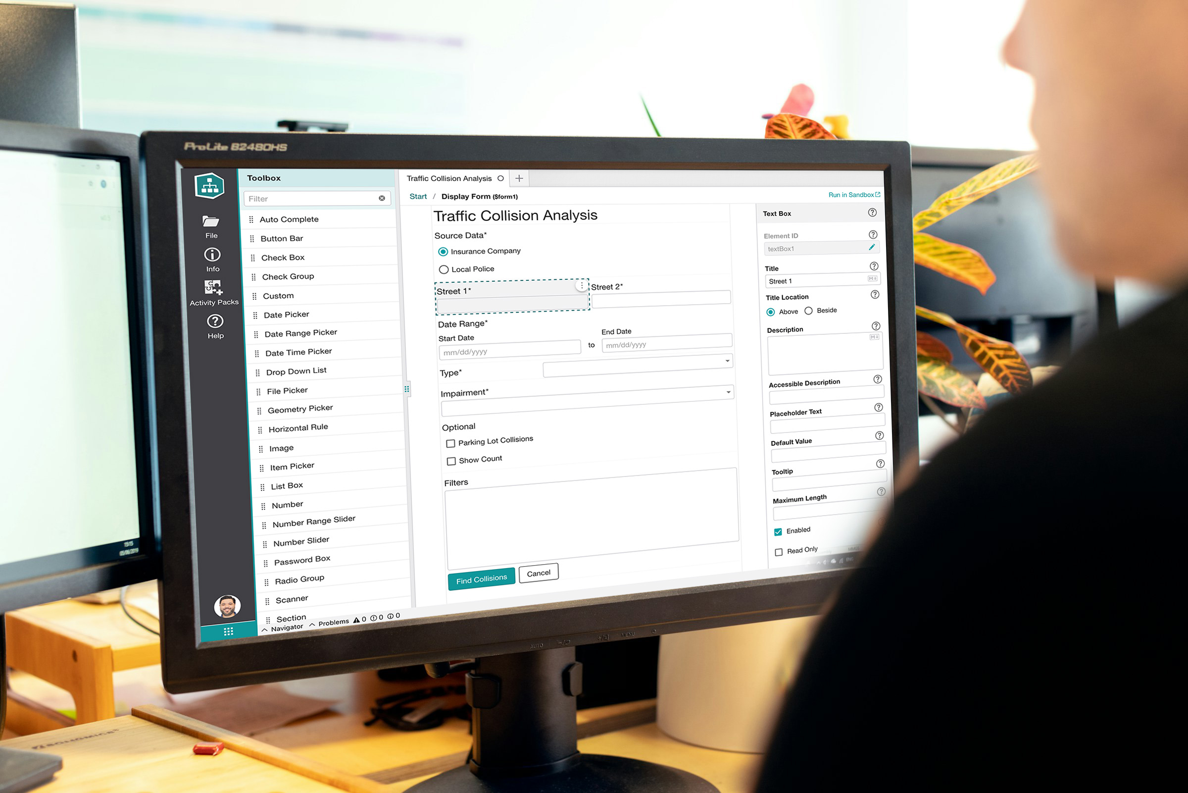
Intuitive Web App for Advanced Custom Functionality
Our intuitive web app redefines the process of creating advanced custom functionality with its user-friendly approach. Utilizing a low-code/no-code solution, users can unleash their creativity without the need for technical expertise.
The intuitive drag-and-drop interface allows users to effortlessly design intricate workflows, customize business logic, and build dynamic web applications—all through a seamless and intuitive experience.
Our web form builder was meticulously crafted to empower users to create custom form layouts while ensuring optimal user experience (UX). With intuitive drag-and-drop functionality and a wide range of customization options, users can effortlessly design forms that align with their brand identity and usability standards.
Comprehensive Icon Set
I spearheaded the creation of a comprehensive set of over 700 custom icons meticulously tailored to reinforce the functionality and brand identity of a cutting-edge GIS application.
These icons seamlessly adapt across various platforms – web, iOS, Android, and Windows apps – ensuring consistent visual representation.
With support for customizable colors, this versatile icon set enhances usability and brand cohesion, delivering a seamless user experience across diverse devices and platforms.